Information Management System
Access the Drin Information Management System here
One of the concerns for sustainable development in the Drin basin identified in the Drin MoU was the need for “improving access to comprehensive data and adequate information to fully understand the current state of the environment and water resources and the hydrological system (including surface and coastal waters) as well as ecosystems of the Drin Basin” (article 3:i). Further, Drin Riparians had agreed that one of the priority actions to address this concern was the “improvement of information exchange through the establishment of a system for regular exchange of relevant information among competent authorities of each party” (Article 4: c).
In response to the stated needs, an Information Management system (IMS) was developed with the support of the GEF Drin project to enable the Drin Riparians to collect, store and share data and information. Moreover, the IMS includes GIS functions and is designed for use in the everyday work of the Drin Riparian ministries responsible for the management of the Drin sub-basins.
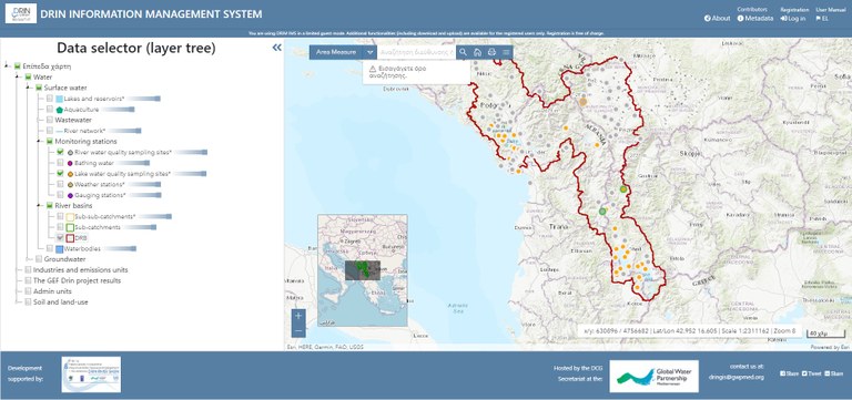
The IMS contains the following types of data:
- Hydrological data including among others hydrography with delineation of 1083 sub-catchments, water level, water flow and annual precipitation (1980-2010) at 68 locations derived from the use of the Panta Rhei model for the Drin river.
- Water pollution related data including among others industrial pollution hots spots, municipal solid waste disposal sites, wastewater outlets and wastewater management infrastructure; surface water, underground water, bathing water quality monitoring stations/sampling locations; 11 years pollution related data series (Drin Riparians’ monitoring data and data generated through monitoring campaigns under the GEF Drin Project and other projects during the past 10 years).
- Socio-economic data including among others population and settlements etc.
- Other baseline data including land use, (hydro)geological and pedological maps, biodiversity related maps etc.
In its initial stage the IMS contained statistically processed data series that were either provided by the countries or produced by the GEF Drin Project in the process for the development of the Drin Transboundary Diagnostic Analysis (TDA) and the implementation of the GEF Drin project demonstration activities. The IMS is used also by other projects such as the Adaptation Fund supported Drin Flood Risk Management project implemented by UNDP and executed by UNDP and GWP-Med.