Lake Skadar/Shkoder sub-basin
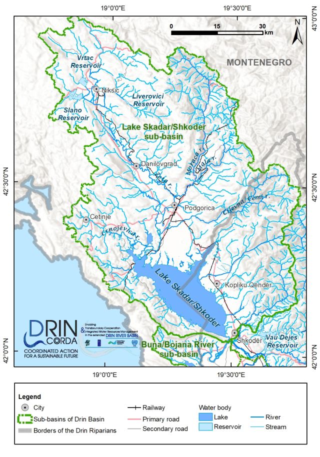
Lake Skadar/Shkodër is a relatively shallow tectonic lake, which has a maximum depth of 9 m. The lake's water level varies widely, with extreme observed values recorded as 4.97 m and 10.31 m (2010 flood). Respective water volumes are 1.8 x 10⁹ m3 and 4.25 x 10⁹ m3. The lake's surface area at the mean water level of 6.52 m is 475 km2.
The main tributary of Lake Skadar/Shkodër is the Morača River, which drains about 32 percent of the territory of Montenegro and contributes around 60 percent of the lake's water. The lake also receives water from springs and groundwater bodies. The Syri i Sheganit and Syri i Zi (in Albania) and Bolje sestre and Karuč (in Montenegro) are the most important perennial springs in this region. They appear as small round lakes with a diameter of 15-20m and have an estimated discharge of 0.15-10 m3 s-1. Several temporary springs also appear on the shore of the lake after intense rainfall or during the snow melt period.