Transboundary Monitoring
Read the final report here  .
.
The region has significant and important groundwater resources. The main uses of groundwater in the Drin Basin are potable water supply and irrigation.
Due to the complex hydrogeological structures, the surface hydrological boundaries often do not coincide with the hydrogeological boundaries of the catchments of surface-water bodies. For example, Lake Prespa has an underground hydraulic connection with Lake Ohrid.
Groundwater resources are often vulnerable to pressure resulting from socio-economic activities. Effects of these pressures affect both nature and humans.
Structured monitoring strategies are paramount to achieving sustainable groundwater resources management and meeting environmental goals. In the case of transboundary aquifer management, structured approaches are necessary in order to facilitate agreement on joint monitoring strategies among the involved countries; once in place, these strategies can enhance trust and cooperation for the management of transboundary water resources.
Responding to the need of establishing transboundary monitoring the GEF Drin project supported a pilot activity implemented in cooperation with UNESCO aiming to design and test a modern multi‐purpose transboundary groundwater monitoring network in the Skadar/Shkoder – Buna/Bojana Delta transboundary alluvial aquifer (Albania & Montenegro) in line with relevant EU legislation. The results will be used to upscale related activities at the Drin Basin level.
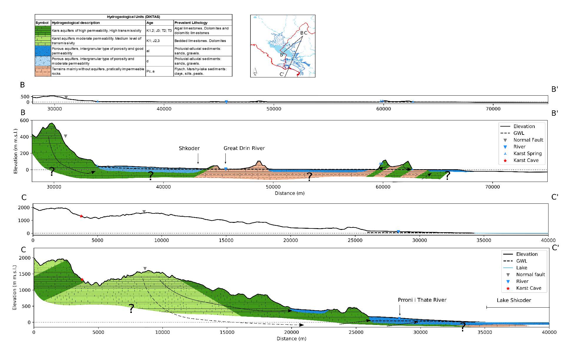
An initial desk-study provided knowledge on the status of the aquifer’s groundwater resources, based on existing information, as well as on information related to surface waters, freshwater ecosystems, and coastal environment. These efforts were then complemented by developing the hydrogeological conceptual model and the aquifer’s comprehensive vulnerability analysis (examining both vertical and horizontal vulnerability) for the study area which later helped in creating the basis for design of the groundwater monitoring network.
The groundwater monitoring programme was tested in the two countries.
Within the framework of this project, and in collaboration with GEF IW:LEARN a webinar on groundwater monitoring, focusing on a hydrogeological context to design a monitoring network of the examined aquifers was organized.
Figure: Conceptual model Montenegrin segment of transboundary aquifer. (1) Equivalent vertical-horizontal scale cross section (2) vertical-horizontal scale exaggeration hydrogeological cross section (3) local hydrogeological cross-section zooming into the Zeta plain intergranular aquifer.
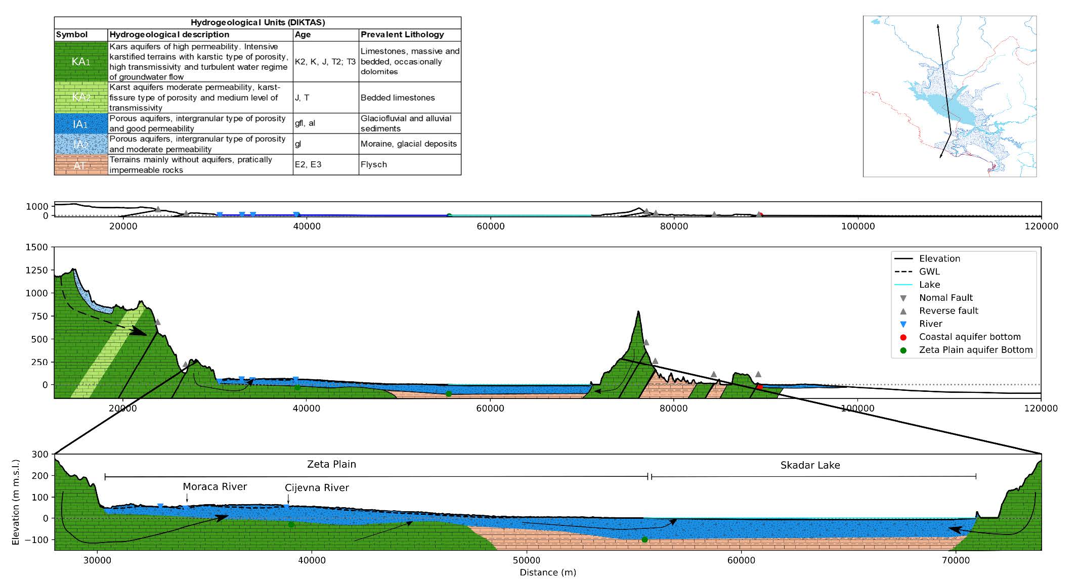
Figure: Conceptual model of the Albanian segment of transboundary aquifer. (1) Hydrogeological cross section towards the sea (2) Hydrogeological cross section of intergranular aquifer contributing to the Skadar/Shkoder Lake.